

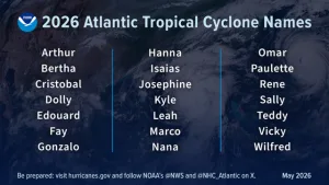
NOAA Predicts Fewer-Than-Average Storms for 2026 Hurricane Season
Boaters in the Gulf and Atlantic coastal regions will be happy to hear that forecasters at the National Oceanic and Atmospheric Administration (NOAA) are predicting a below-normal Atlantic hurricane season this year. An average hurricane season, which runs from June 1 to
November 30, has 14 named storms (winds of 39 mph or higher), of which seven are hurricanes (winds of 74 mph or higher), and three are major hurricanes (winds of 111 mph or higher).
NOAA’s 2026 forecast calls for eight to 14 named storms, three to six becoming hurricanes, and one to three major hurricanes.
A contributing factor to the lower-than-average hurricane forecast is the likelihood of El Niño developing and intensifying in the Pacific Ocean this summer. El Niño conditions in the Pacific, characterized by unusually warm water temperatures, typically lead to stronger upper-level winds and wind shear over the Atlantic Ocean Basin, which help to prevent hurricanes from forming.
NOAA’s National Weather Service (NWS) Director Ken Graham added this caveat to the 2026
hurricane season outlook, however: “Although El Niño’s impact in the Atlantic Basin can often
suppress hurricane development, there is still uncertainty in how each season will unfold. That is
why it’s essential to review your hurricane preparedness plan now. It only takes one storm to
make for a very bad season.”
Many marine insurance providers recommend that boat owners in areas prone to tropical storms
arrange in advance to have their boat hauled and stored on land if a named storm should be
headed their way. If you intend to leave your boat in the water instead, make sure your hurricane
plan includes having it tied up and fendered securely enough to withstand the storm’s high winds
and wave action.
New high-tech forecasting tools
It is also crucial for boat owners to closely monitor the weather throughout hurricane season.
NOAA’s National Hurricane Center (NHC) utilizes advanced technology to provide real-time
storm forecasts at www.nhc.noaa.gov
NOAA recently announced new, high-tech tools it has added to enhance the NHC’s and NWS’
weather forecasting capability this year. They include:
- NHC is implementing an improved version of the tropical cyclone forecast cone graphic
with tropical storm and hurricane watches and warnings for inland areas for the continental United States, Hawaii, Puerto Rico and the U.S. Virgin Islands in addition to coastal regions. - NHC is testing an experimental version of the tropical cyclone track forecast cone that
will capture a greater range of possibilities for the track of the storm by incorporating uncertainties for both direction of movement and timing. - NOAA, in collaboration with the Unified Forecast System community, is testing an experimental high-resolution Seasonal Forecast System that utilizes the latest modeling technology and new methods to assess the evolution of the global ocean-atmosphere system. The system is helping forecasters better simulate tropical storms and hurricanes, and more effectively predict the number of hurricanes and major hurricanes.
- NOAA’s Atlantic Oceanographic and Meteorological Laboratory (AOML) is using machine learning to quality-control data collected from tail Doppler radar – a specialized radar system mounted on the back of NOAA’s Hurricane Hunter aircraft. This new method gathers more than 25% more meteorological data than the current method and leads to more high-quality data.
- For the first time, data from small uncrewed aircraft systems (sUAS) will be integrated into NOAA’s hurricane forecast model. Scientists from the Cooperative Institute for Marine and Atmospheric Studies (CIMAS) and NOAA’s AOML determined that incorporating sUAS data into NOAA’s Hurricane Analysis and Forecast System (HAFS) can improve hurricane intensity forecast accuracy by 10%.
Using a wide range of proven tools and emerging technology ranging from the Hurricane Hunter planes to AI will help NOAA and the NHC ensure that owners with boats in the potential path of a named storm will receive the earliest, most accurate information possible during the 2026 Atlantic hurricane season.